Dreaming of a new-build on the water in Sunset Park? The right lot can deliver everyday sunsets, boat days, and a home that lives beautifully for decades. The wrong lot can trap you in permitting delays, hidden costs, and design compromises. In this guide, you’ll learn how to evaluate a waterfront parcel the way seasoned buyers and small developers do, from orientation and dockability to utilities, permitting, and timelines. Let’s dive in.
Why careful lot evaluation matters in Sunset Park
Waterfront property in Sunset Park carries both premium potential and unique complexity. Jurisdiction, shoreline rules, flood and wind exposure, and long-term maintenance all shape what you can build and how much it costs. If you plan a teardown or a custom home, a lot-level review will help you protect value, align expectations, and structure smart contingencies before you close. Start early so design and permitting move in step.
Orientation and lot geometry
Sun, wind, and views
Lot orientation drives daily light and outdoor comfort. West-facing lots capture evening sunsets, while east-facing lots bring softer morning light. In Florida, prevailing winds are often from the east or southeast, which affects outdoor living design and exposure to salt spray. Also note whether passing boat traffic or nearby channels could add noise and activity to your views.
Width, shape, and depth
Waterfront width influences dock size and placement, as well as separation from neighbors. Narrow frontages can limit the number of pilings or where a lift can go. Overall depth and shape affect yard space between the home and seawall, room for on-lot systems or retention features, and driveway and foundation placement. Review recorded easements, including utility, drainage, and access or riparian easements, that may constrain the buildable area.
Setbacks and buildable area
Expect both upland building setbacks and shoreline-related restrictions. Seawall setbacks, shoreline buffers, and mangrove setbacks can change your home footprint and dock layout. Rules may differ for canal-front lots versus open-bay frontage. Confirm the current code and any overlay districts before you advance design.
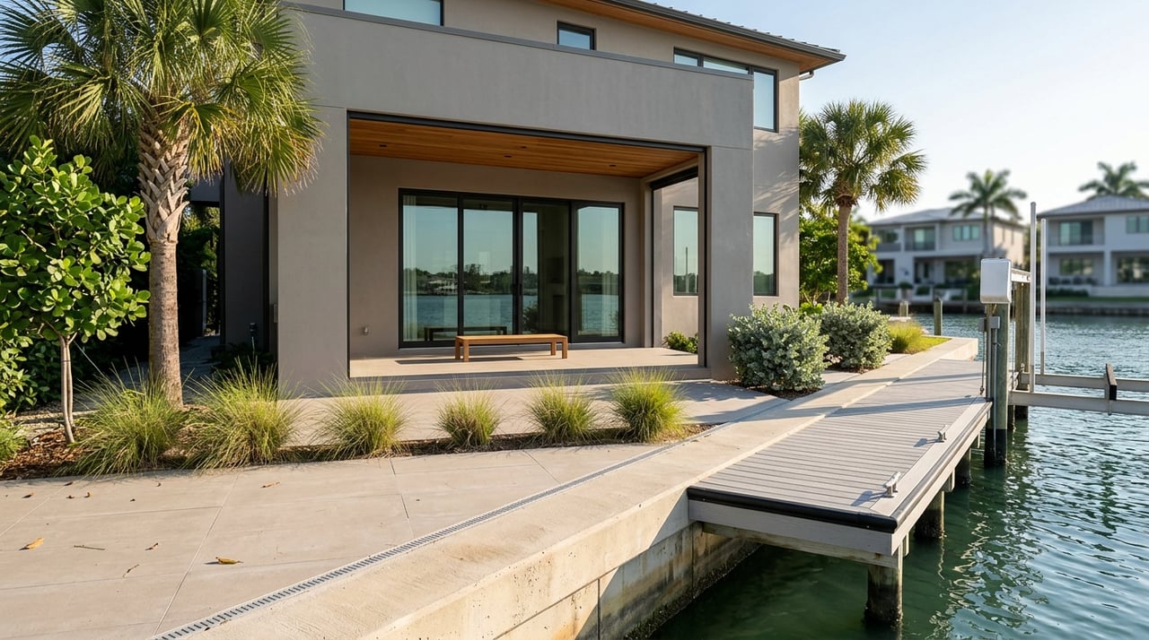
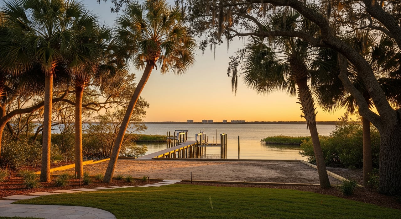
Dockability and access
Depth and tides
Dock feasibility starts with water depth at low and high tide. Depth determines boat size, whether a lift makes sense, and the need for any dredging. Exposure to wake or wave energy may call for more robust dock design. Evaluate whether the lot has adequate upland space to stage equipment and access the dock area during construction.
Bridges and channels
Identify all bridges or low-clearance crossings on your route to open water and verify vertical clearances. Check whether nearby channels are publicly maintained or unmaintained. Channels without maintenance can shoal over time, making access less reliable and dredging more likely.
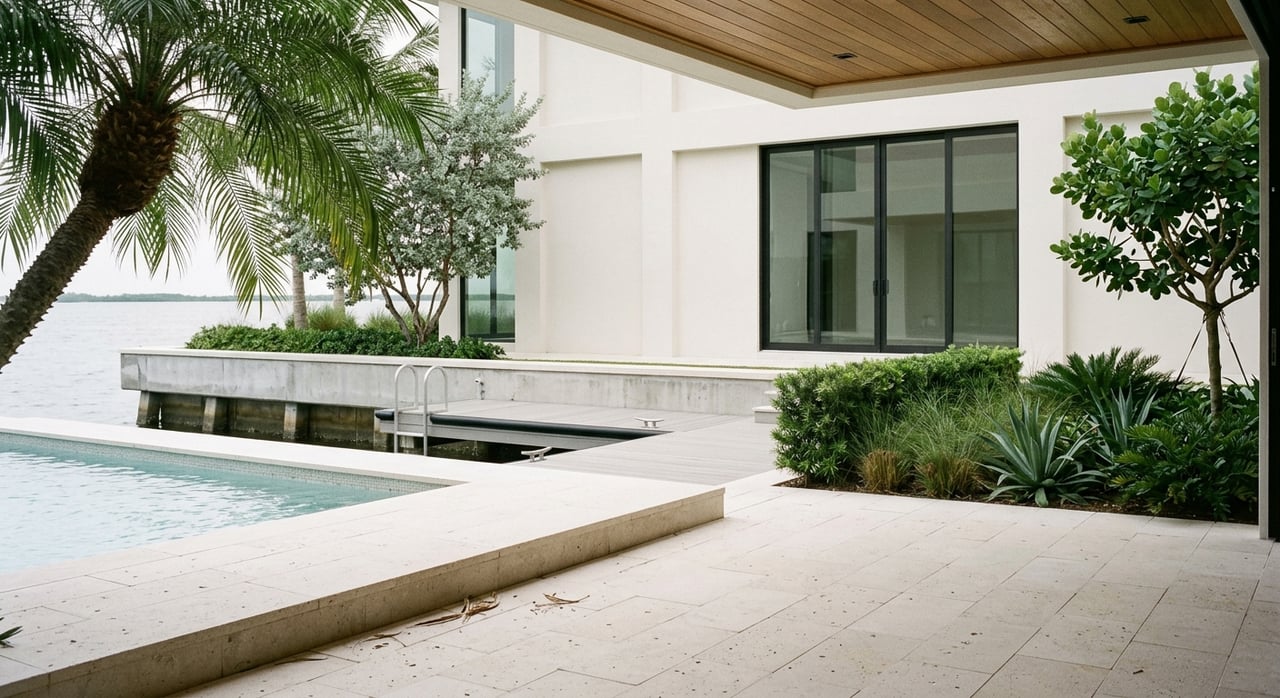
Seawalls and shoreline
Inspect the seawall’s condition and permitting history. A failing or unpermitted seawall can require replacement, which is a high-ticket item and can trigger additional permits. In some areas, living shorelines are encouraged over hard-armoring. Understand what is allowed on your specific shoreline and how that aligns with your desired use and budget.
Utilities and foundation
Sewer and water
Confirm whether the parcel is served by municipal sewer or relies on septic. Coastal lots with limited upland area may make septic systems infeasible. If sewer service requires extension or capacity approval, you could face contribution or assessment costs. Also verify the potable water provider and any service upgrades needed.
Power and communications
Determine whether electric service is overhead or underground at the lot and what it takes to extend service to your new home’s location. Waterfront builds may add routing complexity and cost. Confirm communications providers and availability of high-speed options that meet luxury buyer expectations and smart-home plans.
Geotech and elevation
Order a geotechnical report early. Coastal soils, historic fill, and high groundwater conditions influence foundation type, corrosion considerations, and cost. Obtain current topography and, if available, an Elevation Certificate. Flood zone and Base Flood Elevation will guide minimum finished-floor elevations and flood-resistant construction requirements.
Stormwater and drainage
Even small coastal lots must manage runoff and meet local stormwater rules. Your grading plan, finished-floor elevation, and on-site retention features need to work together. Sandy soils may percolate well, but surface ponding and routing still require careful design.
Permits and environmental rules
Confirm jurisdiction
First, verify whether the lot sits within City of Tampa limits or unincorporated Hillsborough County. Jurisdiction controls zoning, setbacks, building codes, and coastal or shoreline overlays. Use local parcel GIS and the Property Appraiser records, then schedule a pre-application meeting with the correct development services office.
State and federal approvals
Shoreline work and anything waterward of the mean high-water line commonly require state authorization. Docks, seawall work, or dredge-and-fill will typically involve Florida Department of Environmental Protection approvals and may also require U.S. Army Corps of Engineers permits. FEMA floodplain rules and Elevation Certificates will apply to your house permit, and regional water management guidance may be relevant depending on the scope.
Protected resources
Mangroves, seagrasses, wetlands, and critical habitat trigger specialized review and, in some cases, mitigation. Mangrove trimming is regulated, and removal often needs specific authorization. If endangered species or habitat is present, expect additional consultation and possible timing constraints.
HOAs and special districts
Some neighborhoods use HOAs or Community Development Districts to regulate docks, seawalls, and design, and to maintain waterways. These bodies can set standards and levy assessments. Confirm whether any conservation easements or deed restrictions apply to the lot.
Costs and timelines
Big-ticket items to plan for
- Seawall repair or replacement, or permitted living shoreline
- Dock and lift construction sized for your vessel and exposure
- Dredging and potential mitigation, plus any maintenance obligations
- Deep foundations, pilings, and corrosion-resistant materials
- Utility extensions, sewer connections, or septic design and permitting
- Coastal permitting fees, environmental consultants, and survey work
- Flood and wind insurance based on elevation and resilient design
Timing realities
- Shoreline permits that require state and federal review can add months to over a year, especially if mitigation is needed.
- Seasonal constraints for mangrove work and wildlife protection can limit when in-water activities occur.
- House-building permits can be delayed until shoreline issues are resolved, so align your sequencing early.
Your Sunset Park due-diligence checklist
Use this step-by-step list to organize your evaluation and reduce surprises:
Step 1: Confirm jurisdiction and parcel details
- Pull the parcel in the Hillsborough County Property Appraiser GIS and verify City of Tampa or unincorporated county status. Get the recorded plat, legal description, and any deed restrictions.
Step 2: Obtain critical documents
- Request a current survey showing easements and the waterline datum, plus any Elevation Certificate. Ask for the title commitment and HOA documents.
Step 3: Preliminary feasibility studies
- Engage a marine contractor or civil engineer to review water depth, tidal range, dock alignment, and exposure. Check nautical charts and local navigation history. Order a geotechnical investigation to inform foundation design.
Step 4: Utilities and wastewater confirmation
- Verify sewer availability and capacity with the correct provider. Confirm potable water service, electric, and communications providers; request utility as-builts adjacent to the lot.
Step 5: Permitting pre-application and agency outreach
- Schedule pre-application meetings with the appropriate local development services. Start early conversations with state submerged lands staff and the U.S. Army Corps if your plan touches navigable waters or wetlands. Check for any regional water management requirements.
Step 6: Environmental constraints and timing
- Conduct a shoreline habitat assessment for mangroves, seagrass, or wetlands. Identify potential mitigation needs and any in-water work windows that could affect your schedule.
Step 7: Cost and risk analysis
- Obtain preliminary estimates for seawall work, dock construction, dredging, utility extensions, and foundation systems. Request insurance quotes for the proposed design elevations. If there is an HOA or CDD, review financials and recent assessments.
Step 8: Contract contingencies
- Build in contingencies for key permits, elevation requirements, and major cost items like seawall replacement or dredging so you can adjust or exit if needed.
Putting it all together
Great waterfront outcomes start with disciplined due diligence. When you verify jurisdiction, study the shoreline, and align dock, foundation, and utility plans with local rules, you reduce risk and speed up your path to a buildable design. That clarity pays off at closing, during permitting, and when your contractor mobilizes. If you want a trusted, local partner to quarterback the process and coordinate specialists, connect with The Warneke Group to take the next step with confidence.
FAQs
Can I build a private dock on a Sunset Park lot?
- Possibly. Feasibility depends on water depth at low tide, local dock setbacks, submerged-lands authorization, and potential U.S. Army Corps review. Start with a site-specific marine feasibility study and pre-application meetings.
Will I need to replace the seawall before building a new home?
- If the seawall is failing or not properly permitted, replacement is often required and may trigger additional permits. Inspect condition and records early so you can budget and sequence the work.
How long can shoreline permits delay my construction timeline?
- Permits involving state and federal review commonly add months, and more time if mitigation or endangered-species consultation is required. Plan for seasonal constraints on in-water work.
Are flood and wind insurance higher for Sunset Park waterfront homes?
- Typically yes. Premiums depend on finished-floor elevation, foundation type, and wind- and flood-resistant design. Elevation Certificates and resilient construction can help manage costs.
How do I confirm if my lot is in the City of Tampa or unincorporated county?
- Check the Hillsborough County Property Appraiser GIS and local parcel maps, then verify with the appropriate development services office. Jurisdiction sets zoning and shoreline rules.